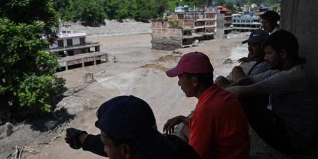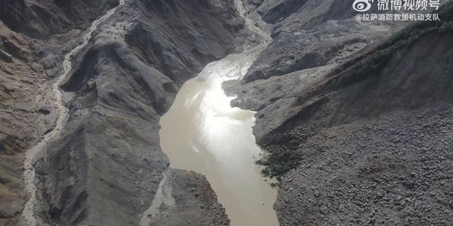
High-altitude pilgrimage expeditions in the Himalayas occupy a unique intersection of extreme geography, volatile meteorology, and operational logistics. When catastrophic systemic failures occur—such as the recent flash floods along the Nepal-Tibet border that stranded hundreds of travelers, including high-profile pilgrimage groups—public discourse typically defaults to emotional narratives of personal tragedy. While these human elements reflect the immediate gravity of such events, they obscure the underlying mechanics of systemic risk management, communication architecture, and emergency response latency in remote terrains.
Analyzing high-altitude disaster vectors requires stripping away anecdotal tragedy to examine the structural vulnerabilities inherent in cross-border Himalayan tourism. Don't miss our recent article on this related article.
The Three Pillars of Expedition Vulnerability
Expedition risk in high-altitude border zones is not uniformly distributed. It is governed by three distinct structural variables that dictate whether a routine pilgrimage transforms into a critical survival scenario.
- Topographic Compression and Hydro-Meteorological Triggers: The geography of the Nepal-Tibet border features steep river gorges and narrow valleys. When unseasonal cloudbursts or glacial lake outbursts occur, water volume is funneled into high-velocity hydraulic corridors. Pilgrimage routes often align with these exact historical trade and river paths, creating an inverted safety margin where the route of travel becomes the primary hazard zone.
- Information Silos and Jurisdictional Friction: Cross-border expeditions operating between Nepal and the Tibet Autonomous Region of China encounter acute administrative fragmentation. Communications infrastructure breaks down rapidly at elevations exceeding three thousand meters. Telemetry data, local weather warnings, and immigration checkpoints operate on disjointed bureaucratic timelines, delaying situational awareness for international families and consular offices alike.
- Logistical Latency in Search and Rescue Operations: The physical isolation of high-altitude plateaus introduces severe operational delays for emergency response teams. Air rescue assets are heavily constrained by thin air density, unpredictable wind shear, and cloud cover. Consequently, the initial response window—the golden hours critical for trauma survival and swift extraction—is frequently squandered due to mechanical and jurisdictional bottlenecks.
The Cost Function of High-Altitude Tourism
The economic and structural expansion of spiritual tourism in fragile ecosystems relies on a dangerous risk-reward imbalance. Tour operators and institutional organizers scale operations to meet high consumer demand for milestone life events, such as sex-agenarian birthday milestones or sacred treks, without proportionally scaling redundancy frameworks. To read more about the history here, USA Today offers an excellent breakdown.
The cost function is weighted heavily toward volume rather than resilience. When an environmental shock occurs, the individual participant absorbs the residual risk. Modern expedition management often treats communication arrays and satellite tracking beacons as optional enhancements rather than baseline prerequisites. This structural flaw transforms minor delays in transit checkpoints into multi-day information blackouts that paralyze family members and emergency coordinators across continents.
Systemic Failure Points in Cross-Border Tracking
The mechanics of losing contact with expedition groups typically follow a predictable operational breakdown. Understanding this sequence illuminates why families experience days of agonizing uncertainty following a disaster event.
- The Checkpoint Disconnect: Travelers register at lowland immigration or border control posts before entering restricted high-altitude zones. Once past these physical gates, cellular connectivity ceases, shifting the tracking burden to satellite links or scheduled check-ins that are easily disrupted by local infrastructure failures.
- The Aggregation Delay: Tour groups travel as distributed nodes. When a flash flood or landslide severs a route, individual sub-groups may find shelter independently. Tour operators often lack real-time telemetry to distinguish between safe sheltering and catastrophic loss, leading to delayed reporting to national emergency coordination centers.
- The Bureaucratic Verification Lag: Local authorities prioritize immediate rescue and clearance operations over individual status verification. International embassies must navigate multi-layered diplomatic channels to obtain confirmed casualty or survivor lists, creating an information vacuum for anxious relatives abroad.
Strategic Operational Redundancy
Mitigating future high-altitude mass casualty and missing-persons events requires a fundamental shift from reactive rescue to proactive systemic architecture. Expedition organizers and regional authorities must institute mandatory real-time telemetry tracking for all commercial and institutional groups entering high-risk border corridors. Furthermore, emergency response protocols must mandate standardized cross-border communication relays that bypass local cellular dependence entirely, ensuring continuous location broadcasting regardless of ground infrastructure integrity.