The Thermal-Topographic Vector
When twelve fatalities emerge from a simultaneous cluster of vegetation fires across northern Algeria, public discourse routinely defaults to exogenous shocks. Media reports frame these events as unpredictable tragedies born of severe seasonal heatwaves. This diagnostic framework is incomplete. Wildfire propagation in Mediterranean ecosystems is not a random stochastic anomaly; it functions as a predictable thermodynamic equation dictated by topography, fuel architecture, and atmospheric vectors.
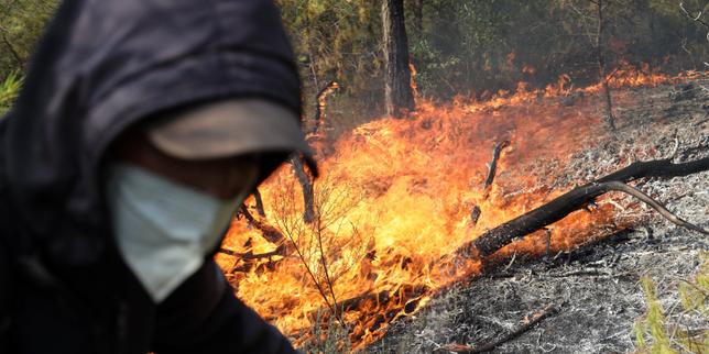
On a single late-August operational window, Algeria's civil protection services logged 154 distinct vegetation fires. Concentrated heavily within the northern littoral and sub-littoral zones—specifically across the provinces of Jijel, Béjaïa, and Tizi Ouzou—the spatial distribution of these incidents exposes systemic vulnerabilities in regional fire ecology and emergency response thresholds. Five deaths in Jijel, four in Béjaïa, and three in Tizi Ouzou highlight the lethal intersection of high-density rural settlement patterns and rapid-onset crown fires driven by katabatic wind phenomena.
The Tripartite Failure Matrix
To understand why traditional suppression models break down under extreme thermal stress, analysts must evaluate the three structural components governing rapid combustion events: fuel load density, microclimate desiccation, and logistical response latency.
Fuel Architecture and Topographic Amplification
Decades of rural depopulation and the decline of traditional agro-pastoral land management have altered Mediterranean shrublands and forests. Unmanaged underbrush accumulates continuous fuel ladders connecting surface vegetation to the forest canopy. When high ambient temperatures combine with severe seasonal drought, the moisture content of this biomass drops below critical ignition thresholds.
The rugged terrain of the Tell Atlas mountain range compounds this vulnerability. Steep slopes accelerate the rate of fire spread through radiant and convective heat transfer. As flames travel uphill, they preheat the vegetation above them, exponentially increasing propagation velocity.
Atmospheric Catalysis
The thermal envelope driving these events is characterized by persistent high-pressure systems inducing prolonged heatwaves across North Africa. Relative humidity plummets while wind speeds increase. Strong winds act as forced-convection engines. They transport glowing embers far ahead of the fire front, generating spot fires that bypass secondary firebreaks and trap civilian populations attempting evacuation along narrow arterial routes.
Response Latency and Asset Distribution
When active fire fronts scale past hundreds of simultaneous ignition points, emergency response systems face an overwhelming triage problem. With 154 active fires recorded on a single day, aerial and ground assets face acute resource scarcity. The geographical dispersion across mountainous terrain stretches transit times for civil protection units. This creates a critical window of vulnerability where local populations, lacking real-time telemetry or structured evacuation protocols, attempt unauthorized self-evacuation or defensive asset preservation.
The Economic and Operational Cost Function
The human cost—twelve dead and over fifty injured, with multiple individuals requiring intensive care—reflects the absence of integrated early-warning systems coupled with defensible space engineering around rural dwellings. Traditional response paradigms rely heavily on reactive suppression. Economically, this approach yields diminishing marginal returns. Every dollar spent on heavy suppression airframes during peak crisis yields lower systemic risk reduction than preventive investments in localized fuel reduction, prescribed burning windows, and hardened infrastructure.
Vulnerable transit corridors, such as the national highways connecting eastern urban centers that experienced emergency closures near Béjaïa and Jijel, demonstrate how systemic choke points paralyze regional evacuation logistics. When smoke reduces visibility to near zero in mountainous passes, linear transport corridors transform into spatial traps.
Strategic Realignment
Mitigating recurring mass-casualty wildfire events requires moving away from crisis management toward predictive risk modeling. Regional authorities must decouple emergency protocols from reliance on meteorological luck. Operational frameworks must incorporate decentralized community-level water reserves, rigid zoning codes restricting residential expansion within high-risk topographic funnels, and automated sensor networks capable of detecting ignition signatures before crown transition occurs. The recurrence of mass-casualty fire events indicates that systemic exposure will continue to scale upward unless structural land management supersedes reactive firefighting.


