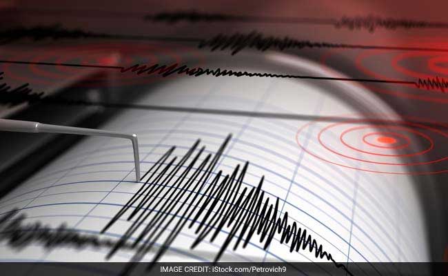
The initial critical window following a subduction zone or fault line rupture demands immediate, binary decision-making based on incomplete telemetry. When a major seismic event occurs, emergency management systems operate under a compressed optimization problem: maximize public safety by ordering immediate evacuations while minimizing the economic and societal friction of false alarms. The event near Te Anau on New Zealand’s South Island serves as a textbook study in real-time data recalibration and its immediate operational consequences on coastal defense infrastructure.
At 9:14 pm local time, the National Emergency Management Agency (NEMA) issued a high-priority land inundation tsunami warning for the southwestern coast of the South Island, spanning from Milford Sound to Puysegur Point. This prompt defensive posture was triggered by early automated telemetry indicating a magnitude 6.3 earthquake centered 40 kilometers north of Te Anau at a depth of approximately 53 kilometers. Within a short operational window, localized data refinement from the national monitoring network, GeoNet, down-scaled the event to a magnitude 5.9. This shift altered the underlying physics of the hazard, moving the threat profile from structural land inundation to localized coastal velocity surges.
The Mechanics of Seismic Recalibration
The transition from a magnitude 6.3 warning to a magnitude 5.9 national advisory highlights the intrinsic lag between automated algorithmic detection and verified human-in-the-loop analysis. Initial estimations rely heavily on automated algorithms that process the first arriving P-waves across the closest seismometers. Because the moment magnitude scale is logarithmic, a variance between 6.3 and 5.9 represents an approximate fourfold difference in energy release.
The mechanical variables that dictate whether an inland earthquake generates a marine threat break down into a strict tri-component framework:
- Displacement Potential: True tsunamis require the vertical displacement of the seafloor water column. The epicentre of this event was located 40 kilometers inland. For an inland quake to generate a marine displacement, it must transmit secondary energy through coastal landslide triggers or belong to a complex fault system extending offshore.
- Depth Attenuation: At a depth of 53 kilometers, the seismic energy must travel through a substantial volume of crust before reaching the surface. This depth serves as an energy buffer, decreasing the likelihood of major surface deformation compared to shallow rifts occurring under 10 kilometers of depth.
- Acoustic and Shockwave Coupling: Even without direct vertical seafloor displacement, deep seismic rifts close to complex fjord systems—such as Milford Sound—can couple acoustic energy into deep, narrow water channels. This creates localized resonant surges rather than a broad-ocean tsunami wave train.
When GeoNet and international agencies like the USGS reconciled the magnitude down to 5.9, the calculated displacement potential fell below the threshold required for significant land inundation. NEMA adjusted its posture accordingly, converting a hard regional evacuation mandate into a marine coastal advisory.
Evacuation Logistical Constraints and the Traffic Bottleneck Paradox
The early phase of the Te Anau event demonstrated the acute tactical vulnerabilities of regional infrastructure. When the initial land inundation warning went live, NEMA explicitly ordered residents to evacuate on foot, by bicycle, or by running, explicitly banning the use of private vehicles unless absolutely necessary.
This directive targets a well-documented vulnerability in emergency logistics: the traffic bottleneck paradox. In high-velocity threat vectors like tsunamis, the time required to clear a chokepoint via vehicular transport scales non-linearly as volume increases. If a coastal town with limited egress routes experiences a surge in vehicular utilization, a complete gridlock occurs within minutes. This effectively traps the population inside a dense collection of metallic structures inside the active inundation zone.
The geographical profile of the Fiordland region amplifies this bottleneck. Te Anau operates as the primary infrastructure gateway to a highly constrained topography defined by steep fjords, single-lane mountain transit routes, and dead-end coastal corridors. In these environments, foot-based vertical evacuation—moving to the nearest topographic high point above designated tsunami zones—holds a much higher success probability than horizontal vehicular flight.
Hydrodynamic Realities of the Downgraded Marine Advisory
The transition to a national advisory does not equal a zero-risk scenario. NEMA’s downgraded status emphasizes that while land inundation is no longer expected, the coastal margins face persistent hydrodynamic instability.
[Seismic Event: M5.9 at 53km Depth]
                 │
                 ▼
[Acoustic/Kinetic Energy Transfer to Marine Inlets]
                 │
                 ▼
[Fjord Resonance & Narrow Channel Amplification]
                 │
                 ▼
[High-Velocity Shoreline Surges & Micro-Tsunami Currents]
The primary hazard shifts from a hydrostatic wall of water to a hydrodynamic current hazard. Deep fjords and shallow estuaries act as hydraulic amplifiers. When long-period wave energy enters a narrow inlet, the conservation of energy forces the water velocity to spike dramatically.
These unpredictable surges generate strong, unusual currents capable of overriding mooring systems, capsizing small craft, and inducing rapid shoreline rip currents. NEMA’s operational directive to clear marinas, beaches, and harbors addresses the specific kinetic energy of these currents, which can persist for hours after the primary seismic waves have passed through the crust.
Emergency managers must treat the period immediately following the downgrade with high operational caution. The first wave arriving at a coastal telemetry station is rarely the largest in the sequence. Wave reflection off underwater topography can cause constructive interference, resulting in delayed peak wave heights two to three hours into the event.
Maritime operators face distinct optimization problems during these events. While standard protocol dictates that deep-sea vessels head to deep water to ride out a wave train, vessels docked in shallow berths or narrow fjords face an immediate hazard if they attempt to navigate restricted channels during active surge cycles. The directive to abandon vessels and seek high land minimizes life safety risk by removing personnel from the high-energy maritime interface entirely.
Deploy autonomous acoustic sensors and real-time tidal telemetry at the outer boundaries of vulnerable fjord systems to decouple local warning systems from initial regional magnitude estimates. This ensures that localized hydrodynamic surges are detected and quantified based on actual water displacement rather than preliminary seismic calculations.