Six people died when Hurricane Simon and the remnants of Tropical Storm Rachel battered Mexico in October 2026. That number looks deceptively small on a wire ticker.
Look closer at what actually happened. While Simon churned off the Pacific coast without making a direct landfall, moisture from the storm and Rachel's fading circulation turned dry arroyos and coastal corridors into flash-flood traps from Guerrero to Baja California. In Ensenada, soldiers used helicopters to airlift 32 people, including 13 minors and 22 foreign nationals such as Americans and Germans, from Rancho Genesis, a missionary-staffed orphan camp cut off by raging water. Down south, heavy rain in Guerrero claimed a life over the weekend, trees and power poles snapped near Acapulco, and Puerto Vallarta paused airport operations as heavy swells and flooded streets tested resort infrastructure.
Basic news summaries stop at the death toll and a quick storm track. Honestly, that leaves out the real story. When two Pacific systems overlap like that, the biggest danger isn't always a 140-mph eyewall hitting a city head-on. It's slow-moving rain, steep coastal topography, and a false sense of security when a hurricane stays offshore.
Why Hurricane Simon and Rachel Floods Hit So Hard
People still fall for a classic coastal myth: if the hurricane center doesn't draw a landfall arrow straight through your town, you're mostly in the clear. That's dead wrong on Mexico's Pacific slope.
Hurricane Simon spent days churning off western Mexico—affecting waters off states including Guerrero, Jalisco, Nayarit, and Sinaloa—while moisture feeds and overlapping tropical systems soaked ground that didn't have time to drain. Meanwhile, Tropical Storm Rachel's remnants pushed north toward Baja California and Southern California, sending rough surf and heavy runoff into regions where steep hills meet narrow valleys.
In places like Ensenada, a dry riverbed or neighborhood stream can go from quiet to violent in minutes. One resident caught in the deluge described hearing a roar like intense ocean waves before stepping outside to find an overflowing stream sweeping away a cabin and animals. Around 300 troops, police, and rescue workers searched river corridors in Ensenada while the Mexican navy hunted for missing fishermen, showing just how fast routine coastal life turned into a search-and-rescue operation.
Offshore hurricanes still flood inland valleys. When terrain funnels heavy rain into steep canyons, water moves faster than local drainage can handle.
📖 Related: When a Train Ticket Forges a Mahatma
What Happened Across Mexico's Pacific Coast
If you only read a single-paragraph recap, you'd think the damage was uniform from south to north. It wasn't. Different stretches of coast got hit in very different ways during the October 2026 event.
Southern and Central Pacific States
Farther south, Guerrero took early weekend punishment as heavy rain triggered flooding and claimed at least one life. Coastal communities around Acapulco dealt with downed trees, toppled power poles, blocked roads, and flooded homes.
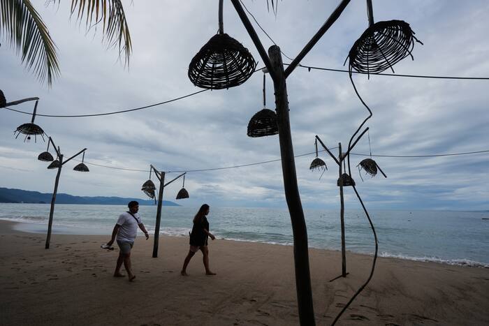
As Simon tracked parallel to the coast, resorts in Nayarit and Jalisco faced big swells, street inundation, and travel disruptions. In Puerto Vallarta, churning water forced airport operations to pause until Tuesday morning, piers were taped off, and residents plus tourists walked beaches afterward sizing up the mess. Even when a storm wobbles or stays tens or hundreds of miles offshore, big swell and squally rain bands can still shut down transit and swamp low-lying streets.
Baja California and Cross-Border Spillover
Up in Baja California, the story shifted toward flash floods, landslides, and isolated communities. Overflowing rivers and slides cut off roads around Ensenada, turning remote properties into islands. The helicopter extraction of 32 people from Rancho Genesis underscored how vulnerable camps, farms, and small settlements sit when access roads wash out.
The spillover wasn't strictly confined to Mexico either. As Rachel weakened into a post-tropical system moving north, heavy surf battered Southern California, damaging a boardwalk and slamming into beachfront homes in Long Beach where some residents had to evacuate. Weather systems don't check passports or state lines, and regional forecasts quickly turned toward follow-on Pacific activity like Tropical Storm Trudy.
The Bigger Climate Picture Behind the Storms
Watching back-to-back tropical systems rattle Mexico in October 2026 raises a bigger question: why does this pattern feel less like a freak fluke and more like a recurring stress test?
Meteorologists pointed to the developing 2026-27 El Niño as a major driver of shifting winds, altered rainfall patterns, and erratic weather, with scientists also noting that human-driven warming can intensify El Niño effects. You don't need to overcomplicate the physics to see the practical result. Warmer ocean water fuels stronger evaporation and moisture transport, while shifting steering currents can park rainmakers or send remnants into places that aren't built for prolonged saturation.
Still, I want to be straight with you about attribution and limits. Pinning any single storm's exact death toll or rainfall total on climate change alone takes careful climate modeling, and official casualty tallies in fast-moving flood events can shift as authorities verify missing persons and remote reports. What's already clear on the ground is that infrastructure—culverts, hillside roads, and emergency evacuation routes—often lags behind extreme downpours.
Mistakes Travelers and Locals Keep Making
Having watched plenty of coastal storms play out, the same avoidable errors show up every time.
First, people treat "hurricane weakens" or "storm stays offshore" as an all-clear signal. A Category 2 or Category 3 system spinning off the coast can still push six or more inches of rain in spots and send heavy surf slamming into seawalls and beaches.
Second, folks drive or walk into moving water because it looks shallow or familiar. Muddy runoff hides washed-out pavement, open drainage grates, and currents strong enough to knock adults off their feet or sweep vehicles sideways.
Third, travelers rely on last-minute airport or hotel updates instead of building buffer days into coastal trips during peak Pacific tropical months. When an airport pauses flights or a coastal highway floods, your itinerary breaks fast.
Practical Steps Before Your Next Pacific Coast Trip
If you live along Mexico's Pacific coast or plan to visit during active tropical weather, a few simple habits save real headaches:
- Check National Hurricane Center advisories and local Civil Protection alerts rather than relying only on social media clips or a single weather app icon.
- Avoid low-lying river crossings, arroyos, and steep hillsides during or right after heavy rain, even if skies look calmer near the coast.
- Keep physical copies of IDs, basic cash, medications, and a charged power bank handy in case power flickers or roads close.
- Build flexible flight and lodging buffers into autumn coastal travel so a one-day weather hold doesn't strand you without options.
For ongoing storm tracking and official advisories, check the National Hurricane Center and follow reporting from Associated Press coverage of the Mexico floods.
At least 6 dead after Hurricane Simon, remnants of TS Rachel brought flooding, landslids to Mexico provides a brief visual news recap of how Simon and Rachel's remnants affected Mexico's Pacific coast.