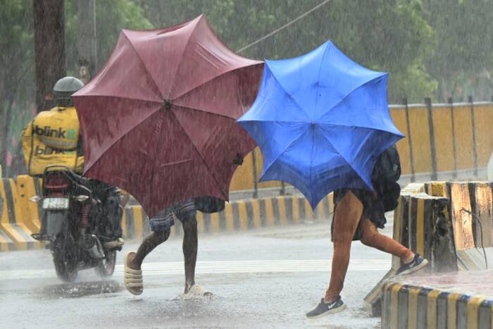
Indian authorities have initiated the mass evacuation of tens of thousands of residents along the eastern coastline of Andhra Pradesh as Cyclone Arnab approaches landfall from the Bay of Bengal. Driven by intensifying wind speeds, heavy rainfall forecasts, and the threat of severe storm surges, state disaster management teams are moving vulnerable populations from low-lying coastal villages into reinforced inland shelters. This rapid mobilization reflects a hardened, zero-casualty doctrine developed over decades of battling lethal tropical systems along the eastern seaboard.
Most initial reports stop at the sheer scale of the human movement. They count the buses, tally the relief camps, and quote standard meteorological advisories. That misses the real story. Moving tens of thousands of people across dozens of coastal districts before a major cyclonic storm makes landfall is not a panic response. It is the execution of a deeply calculated, logistical machine engineered specifically to outrun the deadly geography of the Bay of Bengal.
Why the Bay of Bengal Amplifies Cyclonic Threats
To understand why Andhra Pradesh empties its coastline with such aggressive speed, you have to look at the basin itself. The Bay of Bengal is a meteorological pressure cooker. Unlike deeper, wider ocean basins, it is relatively shallow and enclosed by land on three sides.
When sea surface temperatures climb, the water retains immense thermal energy. Low-pressure systems feed on this heat, rapidly organizing into cyclonic storms with tight, violent eyewalls. Because the bay funnels northward and westward toward the Indian peninsula, storms rarely dissipate out at sea. They are pushed directly onto the continental shelf.
The coastline of Andhra Pradesh acts as a catch-basin for this energy. Stretching nearly a thousand kilometers, the state's shore is characterized by low elevation, sprawling river deltas—specifically the Godavari and Krishna systems—and densely populated agricultural plains.
When a system like Cyclone Arnab pushes ashore, the wind is only the opening act. The real killer is storm surge. As cyclonic winds push ocean water onto the shallow continental shelf, the water has nowhere to go but up and inland. In deltaic regions where the land sits barely above sea level, a surge of even a few meters submerges entire villages, salinizes farmland for years, and cuts off road networks within hours. Evacuation is not optional. Once the surge arrives, rescue becomes impossible.
The Anatomy of a Modern Indian Coastal Evacuation
The operational blueprint unfolding in Andhra Pradesh today did not exist thirty years ago. It was forged in the aftermath of catastrophic failures, most notably the 1977 Andhra Pradesh cyclone and the 1999 Odisha super cyclone, events that claimed tens of thousands of lives because warnings failed to reach the ground and shelters simply did not exist.
Today, the system relies on last-mile connectivity and pre-mapped vulnerability. Days before Cyclone Arnab neared the coast, the India Meteorological Department (IMD) began feeding trajectory models directly into the State Disaster Management Authority (SDMA) command centers. Rather than waiting for exact landfall coordinates—which can wobble right up until the final hours—officials establish a wide buffer zone.
District collectors, who wield immense administrative authority during emergencies, activate village-level secretariats. In Andhra Pradesh, a network of local volunteers and panchayat officials maintains granular registries of coastal residents. They know which houses have thatched roofs, which families include elderly or disabled members, and which hamlets sit inside the high-tide flood zone.
The evacuation happens in waves.
- Vulnerable Demographics First: Pregnant women, the elderly, children, and the chronically ill are moved first using state-requisitioned transport buses and ambulances.
- High-Risk Structure Residents: Families living in mud houses, tin-roofed shanties, or structures within a few kilometers of the surf line are cleared out next.
- Reluctant Holdouts: Local police and revenue officials conduct sweep operations to persuade—and if necessary, compel—residents who fear leaving their livestock and property behind.
These evacuees are routed to Multipurpose Cyclone Shelters (MPCS). Built through joint state and World Bank initiatives over the past two decades, these concrete structures sit on elevated stilts, engineered to withstand wind speeds exceeding 200 kilometers per hour while allowing storm surge waters to pass harmlessly underneath their main floors. In peacetime, they function as schools and community halls. When a cyclone approaches, they transform into self-contained survival hubs stocked with dry rations, potable water, diesel generators, and basic medical supplies.
Infrastructure Hardening and the Power Grid Gamble
Moving people solves the immediate mortality crisis, but a modern cyclone threatens to paralyze the state's economy for months if the infrastructure collapses. Alongside the human evacuation, an equally frantic technical operation takes place across the coastal districts.
Power grids are the most fragile link. High winds snap overhead transmission lines, topple concrete poles, and flood substations. If a live grid goes down in heavy rain and flooding, electrocution hazards multiply and transformers suffer irreparable short-circuit damage. To prevent a systemic meltdown, energy departments execute pre-emptive power shutdowns in targeted coastal feeders hours before gale-force winds arrive.
Simultaneously, heavy machinery is staged just outside the projected impact zone. Teams from the National Disaster Response Force (NDRF) and State Disaster Response Force (SDRF) deploy with inflatable boats, hydraulic cutters, satellite phones, and earthmovers.
Consider a hypothetical example of how this staging works in practice. If a major highway connecting a coastal port to an inland logistics hub is flanked by decades-old banyan and eucalyptus trees, road-clearing crews do not wait for the trees to fall. They position chainsaws and bulldozers at five-kilometer intervals along the corridor behind the storm's expected path. The moment wind speeds drop below dangerous thresholds, these teams push forward to slice through fallen timber, reopening arteries for medical and food convoys before floodwaters can stagnate.
Telecommunications networks undergo similar triage. Mobile operators deploy Cell-on-Wheels (COW) units to elevated inland staging areas, ready to roll into blacked-out zones to restore cellular connectivity once towers lose grid power and exhaust their battery backups.
The Friction Points Nobody Talks About
For all its statistical success in driving down death tolls, India's coastal evacuation model is far from frictionless. Beneath the official press releases of smooth mobilization lies a persistent set of socio-economic tensions that complicate every single storm response.
The biggest obstacle is livelihood attachment. For a small-scale fisherman or a tenant farmer in coastal Andhra Pradesh, a boat, a net, or a pair of water buffalo represents their entire net worth. State shelters accommodate people, not cattle or fiberglass skiffs. Many men refuse to board evacuation buses, opting instead to ride out the storm in vulnerable structures to guard their assets against theft or secure their boats against the rising tide. Local officials frequently have to negotiate compromises, hastily organizing elevated cattle shelters or physically dragging reluctant residents out as the first outer bands of rain begin to lash the coast.
Then there is the problem of warning fatigue. Cyclones in the Bay of Bengal are notoriously erratic. A storm predicted to slam into Visakhapatnam at Category 3 strength can abruptly recurve, weaken over cooler waters, or make landfall hundreds of kilometers away as a heavy rainstorm. When authorities evacuate tens of thousands of people for a storm that ultimately spares their specific village, daily wage laborers lose three to four days of income for nothing. The next time sirens blare, skepticism sets in, forcing disaster teams to expend double the effort to clear the same neighborhoods.
Sanitation and overcrowding inside the shelters also remain chronic weak spots. While the concrete shells of the MPCS buildings are built to endure extreme weather, maintenance budgets often lag during non-emergency years. Generators sometimes fail due to neglected servicing, water tanks run dry faster than anticipated when shelter capacity is exceeded, and disease transmission becomes a secondary threat if floodwaters prevent evacuees from returning home for more than seventy-two hours.
The Shifting Climate Reality in the Eastern Basin
Veterans of India's meteorological and disaster response sectors recognize that the baseline rules are changing. Historically, the Bay of Bengal saw predictable twin cyclone seasons—one in the pre-monsoon months of April and May, and a more active post-monsoon window from October through December.
Warmer ocean temperatures are altering storm behavior. Meteorologists increasingly observe rapid intensification, a phenomenon where a relatively disorganized tropical depression explodes into a severe cyclonic storm within twenty-four hours. Rapid intensification compresses the operational window for state governments. Instead of having four days to calmly notify villages, stage buses, and stock shelters, disaster managers sometimes have less than thirty-six hours to execute a full-scale coastal clearance.
Furthermore, slower-moving storms are dumping unprecedented volumes of rain over single geographic pockets. Even when wind speeds moderate after landfall, stalled cyclonic systems unleash inland flash flooding that overwhelms drainage systems built for twentieth-century rainfall averages. Evacuation maps must constantly be redrawn, pushing the boundaries of what constitutes a "safe" inland zone further away from the coast with every passing decade.
What Happens When the Eye Passes
The true measure of Andhra Pradesh's response to Cyclone Arnab will not be found in the pre-landfall evacuation numbers, impressive as they are. Saving lives during the initial impact is a solved logistical equation for India's coastal states; keeping those survivors healthy and restoring their economic footing in the muddy, power-starved aftermath is where the real test begins.
As Cyclone Arnab makes its approach, thousands of families are sitting on the concrete floors of elevated shelters, listening to the wind howl against shuttered windows, waiting for the all-clear siren so they can walk back to the coast and see what remains of their lives.