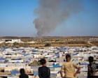
The convergence of consumer-grade Unmanned Aerial Systems (UAS) and real-time communication networks has fundamentally altered the risk profile of civilian extraction in non-permissive environments. Traditional rescue operations require a physical footprint—human assets deployed into a high-threat zone—which introduces a high probability of casualty for the rescuers. The shift toward remote-directed recovery replaces physical presence with information dominance. By utilizing a "Bird’s Eye" tactical oversight, operators can navigate a non-combatant through complex terrain via visual cues or relayed coordinates, effectively treating the individual as a remote-steered asset rather than a passive survivor.
The Triad of Remote Extraction Feasibility
Successful remote rescue is not a matter of luck; it is a function of three measurable variables: technical endurance, environmental transparency, and the cognitive capacity of the target. When any of these pillars fails, the mission transitions from a remote assist to a total loss or a required high-risk physical intervention.
1. Technical Endurance and Signal Propagation
The primary constraint on any drone-led rescue is the power-to-weight ratio of the aircraft. Most small-scale UAS utilized in conflict zones operate on lithium-polymer batteries with a flight window of 20 to 35 minutes. This creates a hard temporal ceiling. If the civilian's movement speed is 2 kilometers per hour and the drone must maintain a visual tether, the operator must factor in "on-station" time versus "return-to-home" requirements. Signal degradation due to electronic warfare (EW) or physical obstructions like reinforced concrete further limits the operational radius.
2. Environmental Transparency
The drone acts as a sensor array that compensates for the civilian's ground-level "fog of war." From a 100-meter altitude, an operator identifies three critical data points invisible to the person on the ground:
- Optimal Pathing: Identifying the path of least resistance through debris or topographical barriers.
- Threat Avoidance: Mapping the location of hostile actors or hazardous munitions.
- Exfiltration Thresholds: Locating the exact point where friendly forces can safely take over physical custody.
3. Target Cognitive Load
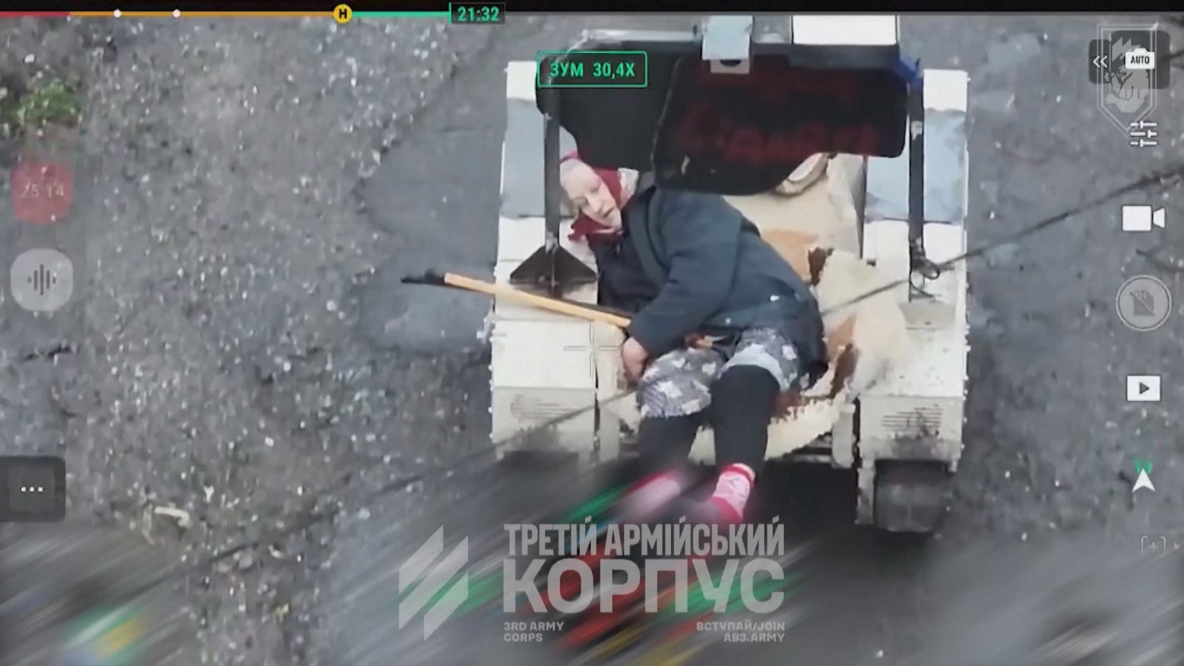
The most volatile variable is the psychological state of the individual being rescued. In high-stress environments, cognitive tunneling—a focus on immediate, often irrelevant details—prevents individuals from following complex instructions. The operator’s task is to reduce the rescued person’s decision-making requirements to binary choices. This is often achieved through physical cues, such as the drone hovering five meters in front of the person and moving in the desired direction of travel, effectively acting as a kinetic guide.
The Information Gap and Tactical Delay
A civilian moving through a war zone faces a massive information deficit. They lack situational awareness beyond their immediate line of sight, typically limited to 10–50 meters in urban wreckage. This creates a tactical delay where every decision (e.g., "should I turn left or right?") is a gamble with a 50% failure rate.
A drone-guided rescue eliminates this delay by providing a persistent overhead view that extends the survivor's situational awareness to a 500-meter radius or more. This 10x increase in visibility allows for "pre-emptive pathing." Instead of reacting to a threat when they see it, the survivor, guided by the drone, avoids the threat before it enters their sensory range. The drone operator functions as an externalized prefrontal cortex, managing the complex navigation logic so the survivor can focus purely on the physical exertion of movement.
Quantifying Risk in the "Last Mile"
The "Last Mile" is the final, most dangerous segment of the extraction where the survivor must cross from a contested "gray zone" into a secured "green zone." The difficulty of this phase is determined by the Exposure Coefficient, a calculation of the time spent in open terrain versus the density of available cover.
Drone operators minimize the Exposure Coefficient by timing movements to coincide with "blind spots" in local surveillance or shifts in active combat. If a survivor must cross an open road, the drone can scout the entire length of the corridor in seconds—a task that would take a ground team minutes of high-risk exposure. If the drone identifies a threat, it can signal the survivor to remain stationary, effectively "pausing" the rescue in a covered position until the threat window closes.
Structural Bottlenecks of Remote Assistance
Despite the tactical advantages, remote-directed rescues are vulnerable to several systemic bottlenecks:
- Communication Asymmetry: In many cases, the civilian does not have a radio or cellular device. The drone must communicate via movement patterns or dropped physical markers (e.g., written notes, chemical lights). This limits the complexity of instructions that can be conveyed.
- Payload Limitations: Small drones cannot provide physical aid. If the survivor is wounded or physically unable to move, the drone's role shifts from a "guide" to a "marker," simply loitering over the location to provide coordinates for a casualty evacuation (CASEVAC) team.
- Atmospheric Interference: Wind speeds exceeding 15 knots or heavy precipitation can ground the fleet, leaving a survivor mid-route without guidance.
The Economics of Distributed Risk
From a strategic standpoint, using a $2,000 UAS to conduct a rescue is an exercise in extreme cost-efficiency. A traditional search and rescue (SAR) mission involves:
- Personnel: 4–12 specialized operators.
- Transport: Armored vehicles or rotary-wing aircraft.
- Risk: The potential for a multi-million dollar asset loss and significant loss of life.
The drone-guided model shifts the risk from biological assets to a replaceable mechanical asset. The only human at risk is the person being rescued, whose risk level is already at a baseline of near-total. By adding a drone, that baseline risk is lowered without increasing the risk to the intervening force. This asymmetrical risk profile explains why drone-led civilian extractions are becoming the default protocol for forward-operating units and NGOs in active conflict zones.
Implementing the Guided-Asset Protocol
To standardize these outcomes, organizations must transition from ad-hoc "remarkable rescues" to a codified Guided-Asset Protocol (GAP). This requires training operators not just in flight mechanics, but in behavioral psychology and non-verbal signaling.
The first phase of a GAP deployment is Threat Mapping, where the drone establishes a 360-degree perimeter around the target. The second phase is Initial Contact, establishing a communication loop through drone oscillation (e.g., dipping the camera for "yes," yawing for "no"). The third phase is Guided Transit, where the drone maintains a lead distance of no more than 15 meters to ensure the survivor does not lose visual contact.
Future iterations of this technology will likely include onboard speakers for direct voice commands and thermal imaging to detect hidden threats through walls, further reducing the cognitive load on the survivor. The ultimate strategic goal is to turn the "fog of war" into a transparent environment where the civilian is simply a node being moved across a digital map by a remote navigator.
Organizations operating in high-threat environments should prioritize the procurement of high-zoom optical drones and the training of "Rescue Pilots" specialized in civilian navigation. The era of the blind rescue is over; the future is a data-tethered extraction where information is the primary survival tool.