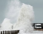
Standard meteorological reporting treats an incoming extratropical cyclone as a series of isolated weather alerts, obscuring the thermodynamic engine driving the disruption and leaving infrastructure operators reactive rather than prepared. When a low-pressure system like Storm Boelo tracks across the North Atlantic toward the United Kingdom, generating wind gusts up to 80 mph alongside concentrated precipitation bands, the operational reality is governed by predictable fluid dynamics, baroclinic instability, and compound hydrological failure modes. Understanding how to manage the resulting systemic risk requires separating sensationalized headline metrics from the underlying atmospheric physics and ground-level infrastructure vulnerabilities.
The Thermodynamic Architecture of Storm Boelo
A named winter windstorm in the North Atlantic is not a random atmospheric anomaly; it is the direct consequence of steep horizontal temperature gradients colliding with upper-tropospheric jet stream dynamics. Storm Boelo represents a classic mid-latitude baroclinic cyclone. Cold, dense polar air masses descending from the Arctic or Greenland meet warm, moisture-laden tropical maritime air moving northeastward from the Azores. The boundary between these two air masses—the polar front—becomes unstable when an upper-level trough in the jet stream diverges air aloft faster than surface air can converge to replace it.
This upper-level divergence forces a rapid drop in surface barometric pressure, a process known as cyclogenesis. As central pressure falls, the pressure gradient force—the physical mechanism pushing air from high-pressure zones toward the low-pressure core—accelerates sharply. In the northern hemisphere, the Coriolis effect deflects this inward-rushing air counterclockwise, creating the tight cyclonic rotation characteristic of high-impact UK storms.
The specific threshold of 80 mph gusts mentioned in baseline forecasts is rarely the result of sustained mean wind speeds alone. Instead, peak gusts of this magnitude originate from two distinct boundary-layer mechanisms:
- Convective Downdrafts along the Cold Front: As the storm's cold front sweeps eastward, dense cold air undercuts warm, moist air, forcing rapid vertical ascent. This triggers narrow bands of intense convective precipitation. As rain falls through drier mid-level air, evaporative cooling increases the density of the air parcel, causing it to plunge toward the surface and spread outward as a localized high-velocity gust front.
- The Sting Jet Phenomenon: In rapidly deepening cyclones—specifically those undergoing explosive cyclogenesis, or "bombogenesis"—a narrow, descending core of exceptionally high-velocity air can peel away from the mid-troposphere (roughly 2 to 3 miles up) and slam directly into the boundary layer just south of the storm center. While not every 80 mph storm possesses a confirmed sting jet, the presence of dry intrusions on water vapor satellite imagery serves as the primary diagnostic indicator for wind speeds exceeding standard gradient flow models.
Deconstructing the Kinetic Energy Curve of 80 mph Gusts
Media coverage frequently treats wind speeds linearly, implying that an 80 mph gust is merely 33 percent worse than a 60 mph gust. In structural engineering and forestry management, this assumption is fatal. Wind load—the actual physical force exerted against a vertical surface such as a transmission tower, high-sided vehicle, or building facade—scales with the square of the wind velocity, expressed as $F = \frac{1}{2} \rho v^2 C_d A$, where $\rho$ is air density, $v$ is velocity, $C_d$ is the drag coefficient, and $A$ is the cross-sectional area.
Furthermore, the kinetic energy flux—the power available to cause structural failure or uproot mature timber—scales with the cube of the wind speed ($v^3$).
- The 50 mph Baseline: At 50 mph, wind exerts approximately 6.4 pounds of pressure per square foot. Damage is largely confined to loose debris, unsecured temporary structures, and weak, deadwood branches.
- The 65 mph Inflection Point: At 65 mph, pressure rises to 10.8 pounds per square foot—a 69 percent increase in physical load from a 30 percent increase in speed. Aerodynamic buffeting begins to destabilize high-sided heavy goods vehicles (HGVs) on exposed viaducts and coastal causeways.
- The 80 mph Structural Threshold: At 80 mph, dynamic wind pressure reaches 16.4 pounds per square foot. The kinetic energy flux is more than four times greater than at 50 mph. At this threshold, healthy, shallow-rooted trees (particularly conifers or deciduous trees retaining late-season foliage) experience root-plate failure. Overhead power lines encounter catastrophic cascading failures not from the wind itself, but from wind-borne debris and timber strikes across the distribution network.
Geographical topography dictates how this kinetic energy is distributed across the UK. Exposed western and southwestern coastlines—such as Cornwall, Pembrokeshire, and the Hebrides—absorb the initial unattenuated marine fetch, where low surface friction allows boundary-layer winds to strike at full velocity. As the storm moves inland, surface roughness from urban terrain and rolling hills slows the mean wind speed, yet paradoxically increases mechanical turbulence. This turbulence generates sharper, more erratic gusts in the lee of mountain ranges such as the Pennines, Snowdonia, and the Scottish Highlands, where downslope windstorms can locally accelerate airflow beyond coastal readings.
The Compound Hydrological Risk Function
Wind velocity captures public attention, yet precipitation volume and antecedent soil conditions dictate the long-term economic cost of an extratropical cyclone. Storm Boelo brings heavy rain not as an independent variable, but as part of an atmospheric river—a concentrated filament of water vapor transported from the subtropics ahead of the storm's cold front.
To evaluate flood risk accurately, analysts must calculate the Compound Hydrological Risk Function, which relies on three interacting variables rather than total millimeter rainfall alone:
- Antecedent Soil Moisture Deficit (SMD): If Storm Boelo arrives following a prolonged dry period, upper soil horizons possess significant pore space to absorb infiltration. Conversely, if previous Atlantic depressions have already saturated the ground (an SMD near zero), infiltration capacity drops to near nothing. Every millimeter of incoming rain converts immediately into surface runoff.
- Orographic Enhancement: As moist marine air encounters the elevated terrain of western Britain, it is forced upward, cooling adiabatically and condensing rapidly. Rainfall totals over high ground in Cumbria, Wales, and western Scotland routinely exceed lowland totals by a factor of three to four. This water drains rapidly down steep, rocky catchments into narrow river valleys, creating flash-flooding conditions hours after the front has passed.
- Tidal Locking and Storm Surge: Low atmospheric pressure physically raises the sea surface (the inverse barometer effect, yielding roughly 1 centimeter of sea-level rise per hectopascal drop in pressure). Combined with onshore gale-force winds piling water against the coast, this creates a storm surge. If this surge coincides with a high spring tide, coastal estuaries become hydraulically locked. River water attempting to discharge into the sea backs up, causing severe fluvial flooding in low-lying coastal towns even when inland rainfall totals appear moderate.
Systemic Failure Cascades Across UK Infrastructure
When 80 mph gusts coincide with saturated catchments, the resulting disruption follows a predictable sequence of infrastructure failures. Operational teams managing logistics, energy, or municipal services must anticipate these second- and third-order effects rather than reacting to isolated incidents.
Transport and Logistics Bottlenecks
The UK transport network operates with minimal buffer capacity, making it exceptionally vulnerable to single-point failures during severe weather.
- Rail Network: Network Rail enforces blanket speed restrictions (typically 50 mph) when high winds are forecast. This measure prevents trains from striking fallen trees at high speed and reduces the risk of dewirement—where wind pressure blows the overhead catenary wire off the train's pantograph. While operationally necessary, speed restrictions reduce line capacity by up to 40 percent, causing crew and rolling-stock displacements that persist for 24 to 48 hours after the storm clears.
- Road Freight: Bridges across major estuaries—such as the Severn Crossings, the Humber Bridge, and the Forth Road Bridge—require closure to high-sided vehicles once crosswinds exceed 50 to 60 mph. Rerouting freight onto secondary A-roads concentrates heavy traffic onto routes poorly suited for high volume, where localized surface water flooding and fallen timber rapidly cause gridlock.
Energy Distribution and Telecommunications
The UK transmission grid (high-voltage pylons) is engineered to withstand extreme wind loads, rarely failing during storms like Boelo. The vulnerability lies entirely in the low- and medium-voltage distribution networks—specifically the 11kV and 33kV wooden-pole overhead lines prevalent in rural areas.
When saturated soil softens the ground, the lateral holding capacity of tree roots drops by up to 50 percent. Consequently, an 80 mph gust during heavy rain uproots significantly more trees than an identical gust during dry conditions. Tree strikes sever overhead conductors, triggering automated circuit breakers. Because utility crews cannot legally or safely work at height in mobile elevated work platforms once wind speeds exceed 35 to 40 mph, restoration cannot begin until the rear flank of the cyclone exits the region.
Extended power outages subsequently degrade telecommunications. While core fiber exchanges have multi-day battery and diesel generator backups, local cellular base stations typically rely on battery reserves lasting between two and four hours. Once local grid power fails, rural mobile coverage collapses, severing emergency communication channels and disabling automated telemetry on water pumping stations.
Distinguishing Meteorological Fact from Operational Uncertainty
Effective crisis management requires acknowledging the hard limits of numerical weather prediction (NWP). Global models—such as the European Centre for Medium-Range Weather Forecasts (ECMWF) and the Met Office Unified Model—resolve large-scale synoptic features with high accuracy 48 to 72 hours out. The existence, general trajectory, and broad intensity of Storm Boelo are established facts well before landfall.
However, mesoscale details remain probabilistic until hours before impact:
- Exact Track of the Low Center: A shift of just 30 miles north or south in the cyclone's core trajectory alters which regions experience the benign, relatively calm eye versus the destructive southern flank where gradient winds and forward storm motion combine additively.
- Convective Line Intensity: While models accurately predict the total moisture available in the warm sector, pinpointing the exact towns that will sit beneath a stalled, training convective cell—and thus receive 60mm of rain in two hours rather than 15mm—exceeds the deterministic resolution of standard operational forecasts.
- Localized Gust Amplification: Anemometers at official weather stations are situated in open, standardized environments at 10 meters above ground level. Wind speeds funneled between urban high-rises or accelerated over specific topographic ridges can exceed official readings by 15 to 25 percent, creating micro-zones of severe structural damage that broad regional warnings fail to capture.
Tactical Risk Mitigation Protocol for Operations
Relying on generalized colour-coded weather warnings (Yellow, Amber, Red) is insufficient for commercial and municipal operations, as these warnings blend hazard likelihood with broad population impact rather than specific asset vulnerability. Organizations operating across affected UK regions must execute a tiered, threshold-based protocol ahead of Storm Boelo's arrival.
Phase 1: T-Minus 24 Hours (Pre-Positioning and Asset Hardening)
- Audit Surface Drainage: Clear leaves, silt, and debris from storm drains, culverts, and flat-roof scuppers across all facilities. Localized urban flooding is frequently caused by blocked intake grates rather than overwhelmed municipal sewers.
- Secure External Inventory: Bind, weight, or move indoors all loose yard materials, scaffolding boards, temporary signage, and unanchored containers. At 80 mph, an unsecured sheet of plywood becomes a lethal projectile capable of breaching building envelopes and causing catastrophic internal water damage.
- Verify Backup Power Fuel States: Test-run diesel generators under load and confirm fuel tanks are at 100 percent capacity. Ensure automatic transfer switches are set to auto, and pre-stage portable pumps in basement levels or low-lying utility vaults.
Phase 2: T-Minus 6 Hours (Operational Drawdown)
- Halt High-Risk Logistics: Cancel or delay non-essential HGV dispatches scheduled to transit exposed coastal routes, Pennine passes, or major estuarial bridges during the peak wind window. Redirect critical time-sensitive cargo to rail-freight corridors only if routes utilize underground or non-electrified diesel traction less susceptible to catenary dewirement.
- Transition Workforce to Remote Operations: Issue mandatory work-from-home directives for non-essential personnel at least four hours prior to the onset of 60 mph gusts. Keeping commuters off the road prevents secondary casualties from falling timber and ensures emergency corridors remain unobstructed for utility and rescue vehicles.
Phase 3: Active Impact Window (Monitoring and Containment)
- Shift from Synoptic Forecasts to Live Radar and Telemetry: Stop relying on text forecasts once the cold front makes landfall. Monitor live rainfall radar loops to track the exact movement of squall lines, and cross-reference river-level telemetry gauges upstream of critical assets to gain a two-to-four-hour lead time on fluvial cresting.
- Enforce Strict Stand-Down Rules: Prohibit all external maintenance, roof inspections, or tree-clearance activities until sustained wind speeds drop below 35 mph and gusts remain under 45 mph for at least one hour. Most storm-related fatalities occur during the immediate aftermath when untrained personnel attempt to clear fallen branches entangled with live, downed power lines.
Strategic Forecast and Infrastructure Directive
Storm Boelo is not an outlier event; it is a baseline data point in a warming North Atlantic climate system. Thermodynamic law dictates that a warmer atmosphere holds approximately 7 percent more water vapor per degree Celsius of warming (the Clausius-Clapeyron relation). While climate models show mixed signals regarding the total frequency of North Atlantic cyclones, the moisture content and latent heat release within these systems are rising measurably, intensifying both convective wind gusts and extreme precipitation rates.
Organizations and municipal planners must abandon the legacy model of treating 80 mph windstorms and heavy rain as temporary disruptions to be endured and repaired after the fact. Capital allocation must shift immediately toward decentralized grid resilience, undergrounding vulnerable 11kV distribution lines in heavily wooded corridors, and enforcing strict hydrological runoff attenuation standards across upstream catchments. Until physical infrastructure is hardened to match the non-linear kinetic and hydrological realities of modern Atlantic cyclones, every winter storm track will continue to trigger predictable, preventable systemic failures.