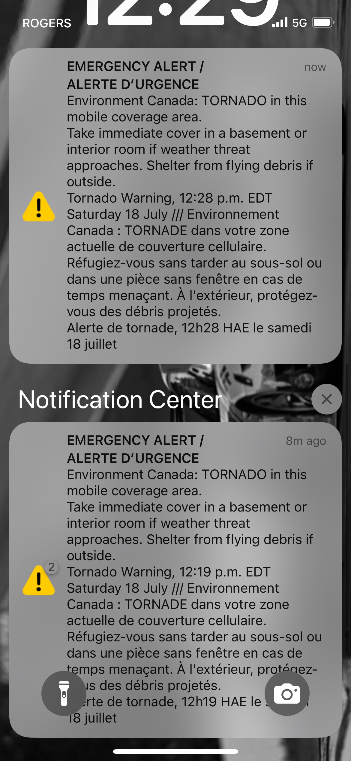
You hear the siren or get the blaring red alert on your phone, and your stomach drops. It happened again today across southern Ontario. For less than an hour on Saturday afternoon, communities from Milton to Mississauga were thrown into a high-stakes waiting game. Environment Canada slapped down a red-level tornado warning, telling people to drop everything and take cover. Then, just like that, the alert was lifted at 12:49 p.m.
It's easy to look at that timeline and shrug it off as a false alarm. You might think the meteorologists are just playing it safe or overreacting. That is a dangerous mistake. Today's wild weather ride across the Greater Toronto Area wasn't an isolated fluke. It was a textbook demonstration of how unpredictable our summer storms have become, especially when you throw massive wildfire smoke plumes into the mix.
Understanding what actually happened on July 18, 2026, requires looking past the simple notification on your phone screen. The real story involves a clash of atmospheric forces that almost turned a standard rainy Saturday into a disaster.
The Anatomy of the July 18 Scare
The trouble started brewing early in the day. A volatile cold front sweeping out of Michigan moved southeast across the border, hitting an incredibly warm, humid air mass sitting over southwestern Ontario. When a fast-moving cold wall slams into heavy, moist air, the atmosphere acts like a shaken soda bottle.
By noon, the clouds turned ominous. Environment Canada spotted severe rotation on their radar just east of Milton. This wasn't just a heavy downpour. The cell was moving fast, charting a course straight toward heavily populated areas in Oakville, Burlington, Mississauga, and Brampton.
Timeline of the Storm Event (July 18, 2026)
-------------------------------------------
11:00 a.m. - Toronto hits #2 worst global air quality due to smoke.
12:00 p.m. - Cold front meets warm air; radar shows severe rotation near Milton.
12:38 p.m. - Red-level Tornado Warning officially issued for Halton and Peel.
12:49 p.m. - Tornado warnings lifted; downgraded to severe thunderstorm watch.
The weather agency didn't mince words. They called it a very dangerous and potentially life-threatening situation. The cell threatened to pack wind gusts up to 110 kilometers per hour, quarter-sized hail, and torrential rain.
Public events immediately felt the squeeze. In Brampton, officials scrambled to delay the Canada Celebrates the FIFA World Cup 2026 community activation event. Meanwhile, organizers of Toronto’s Caribbean Junior Carnival Parade had already thrown in the towel earlier in the morning, rescheduling the massive parade to Sunday, July 19. Safety had to come first.
Then, right around 12:49 p.m., the immediate rotation threat dissipated. The red warnings disappeared, replaced by a yellow-level severe thunderstorm watch.
The Unseen Factor of Wildfire Smoke
What most people don't realize about today's storm is that it fought a quiet battle against a thick layer of smoke. Northwestern Ontario has been battling severe forest fires, and the smoke drifted south, choking the GTA. In fact, on Saturday morning, Toronto found itself sitting at the number two spot globally for the worst air quality, trailing only New York City.
The smoke was so thick that Environment Canada maintained a yellow-level air quality warning throughout the day. Fine particulate matter, known as PM 2.5, spiked to troubling levels across the region.
- Toronto: 72 to 80 micrograms per cubic metre
- Oshawa: 60 micrograms per cubic metre
- Oakville: 51 micrograms per cubic metre
- Mississauga: 47 micrograms per cubic metre
- Brampton: 43 micrograms per cubic metre
These tiny particles do more than just make your eyes water and your throat burn. They actively mess with the weather.
Thick smoke blocks incoming solar radiation. When sunlight can't hit the ground fully, the surface doesn't heat up as fast. Surface heating is the fuel that thunderstorms use to grow into monsters. By keeping the ground slightly cooler, the wildfire smoke likely choked out some of the energy the storm needed to sustain a full-blown tornado.
Meteorologists knew this was a possibility, but you can't bet public safety on smoke density. The rotational energy on the radar was real. If that smoke layer had been just a bit thinner, Saturday afternoon could have looked completely different for the residents of Peel and Halton.
Why a Lifted Warning Isn't a Green Light
When the weather tracking maps turn from red back to yellow, a lot of people think the danger has passed entirely. That mindset gets people hurt. A severe thunderstorm watch means the ingredients for severe weather are still sitting in the kitchen.
The Toronto and Region Conservation Authority immediately issued a flood outlook following the storm. High-intensity rainfall can overwhelm municipal drainage systems in minutes. Watercourses, creeks, and rivers across Mississauga and Toronto began rising rapidly.
If you're driving right after a tornado warning is lifted, you're stepping into a minefield of localized hazards. Flash flooding can wash out culverts. High winds leave weakened tree branches hanging by a thread, waiting for a minor gust to drop them onto power lines or passing cars.
What You Should Do Every Time the Alerts Hit
We get comfortable. We see alerts, nothing happens, and we assume the next alert is also a bust. Break that habit right now. When a red-level warning goes live, you have minutes to react.
If you are inside a house or building, head straight for the lowest level. A basement is best. If you don't have one, find an interior room on the ground floor, like a hallway, closet, or bathroom. Put as many walls between yourself and the outside as possible. Stay away from windows and glass doors.
If you are caught out on the open water when threatening weather approaches, you're in a terrible spot. You need to get to shore immediately. If you can't reach land, put on a lifejacket, get as low in the boat as possible, lie face down, and protect your head from flying debris or hail.
For those on the road, don't try to outrun a rotating storm. Avoid low-lying areas and underpasses, which can trap your vehicle in rising water faster than you can open your door. If you see water pooling across the blacktop, turn around.
Keep your phone charged and keep an eye on official weather apps. Don't rely purely on social media chatter, which is often minutes behind the actual radar updates. Secure your outdoor gear, clear out your closest storm drains if it's safe to do so, and stay indoors until the system completely clears the region. Storms move fast, but you can move faster if you're prepared.