Water does not check passports. It does not pause at checkpoints, nor does it recognize the arbitrary lines drawn by surveyors on maps half a world away. When the monsoon swells the high-altitude tributaries of the Himalayas, the water simply obeys gravity. It rushes downward, carving through stone and spilling across valleys with an indifferent fury. Yet, when those sudden, violent floods sweep across the Nepal-China border, washing away bridges and inundating remote mountain settlements, the resulting crisis is rarely treated as a mere act of nature.
Instead, the water crashes into a wall of bureaucracy.
Stand on the banks of the upper borderlands during the rainy season, and you can smell the damp earth long before the deluge arrives. The air turns heavy, thick with the scent of pine needles and wet slate. The sound comes next—a low, rhythmic grinding as boulders the size of houses are tumbled downstream like river glass. For the villagers whose ancestors have farmed these steep terraces for centuries, this roar is a familiar terror. They know the river. They respect its seasonal moods.
What they cannot predict, however, is the silence that follows from across the political divide.
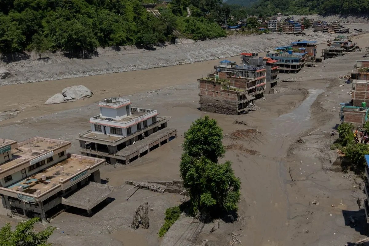
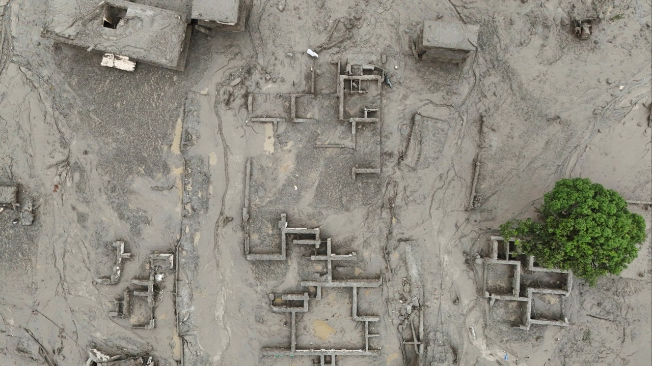
Consider a hypothetical village nestled just feet from the international boundary line. Let us call it Lapcha. In Lapcha, houses are constructed from stacked stone and weathered timber, built to withstand the bitter mountain winds. But they were never built to withstand unannounced surges of water released from upstream barrier lakes or hastily managed infrastructure across the frontier. When a sudden flood breaches containment zones or overflows artificial bottlenecks miles away in Tibet, the residents of Lapcha receive no early warning klaxon. They do not get a phone call, an emergency broadcast, or a diplomatic wire. They simply wake up to find their potato fields buried under three feet of grey silt.
This is where the geography of blame begins.
Behind every catastrophic overflow along this rugged frontier lies a complex web of hydro-politics, stalled treaties, and diplomatic friction. Rivers like the Bhote Koshi and the Karnali do not originate in a single jurisdiction. They are transnational arteries, fed by glacial melt and seasonal rains that care nothing for sovereignty. When China constructs upstream infrastructure—access roads, flood control barriers, or hydroelectric projects—the hydrological dynamics of the entire basin shift. A channel narrowed here means a torrent forced there.
Yet, information sharing between Beijing and Kathmandu remains frustratingly opaque. During peak monsoon months, timely data regarding water levels and dam releases can mean the difference between survival and total displacement. When that data is delayed or withheld behind diplomatic protocols, the river becomes a weapon of geography.
I remember talking with an elder from a border-adjacent community who pointed out across the grey, churning expanse of a swollen channel. His calloused hands gripped a wooden walking stick so hard his knuckles shone white. He did not speak in political jargon or cite international water law. He simply asked why the mountains had grown so loud at night. He asked why the neighbor upstream could turn a valve or watch a gauge while the people downstream were left to measure catastrophe in lost livestock and ruined harvests.
His question cuts to the core of the modern geopolitical dilemma.
Infrastructure development in high-altitude environments requires absolute transparency. When engineering projects alter natural drainage patterns in fragile seismic zones, the margin for error shrinks to zero. A poorly managed landslide barrier or an uncoordinated release of accumulated meltwater does not stay contained within territorial waters. It cascades downward, punishing the most vulnerable populations who had no voice in the initial planning meetings.
Diplomacy in the shadow of the Himalayas often moves at the speed of glacier ice, while disaster moves like an avalanche.
Bureaucrats in capital cities sit in air-conditioned conference rooms drafting memorandums of understanding, debating sovereignty clauses, and haggling over joint inspection protocols. Meanwhile, down in the gorges, the riverbank gives way. A suspension bridge snaps like a dry twig, isolating entire communities from medical care, trade, and schools. The human cost of these diplomatic standstills is paid in isolation, trauma, and the quiet grief of families watching their ancestral lands wash away into the turbid current.
Fixing this dynamic requires a fundamental shift in how nations view shared waterways. Rivers cannot be treated as sovereign territory to be managed in isolation behind closed doors. They are interconnected ecosystems demanding radical cooperation. Real-time hydrological telemetry must be shared instantly, regardless of political tensions or diplomatic coldness. Early warning systems must be jointly operated, maintained, and trusted by the communities most at risk.
Until that happens, the monsoon will continue to expose the fragility of human borders.
The clouds gather dark and heavy over the snowy peaks, casting long shadows across the valleys. Down below, in the darkening twilight, the river keeps rising, cutting ruthlessly through the stone, indifferent to the treaties that were never signed and the warnings that were never sent.