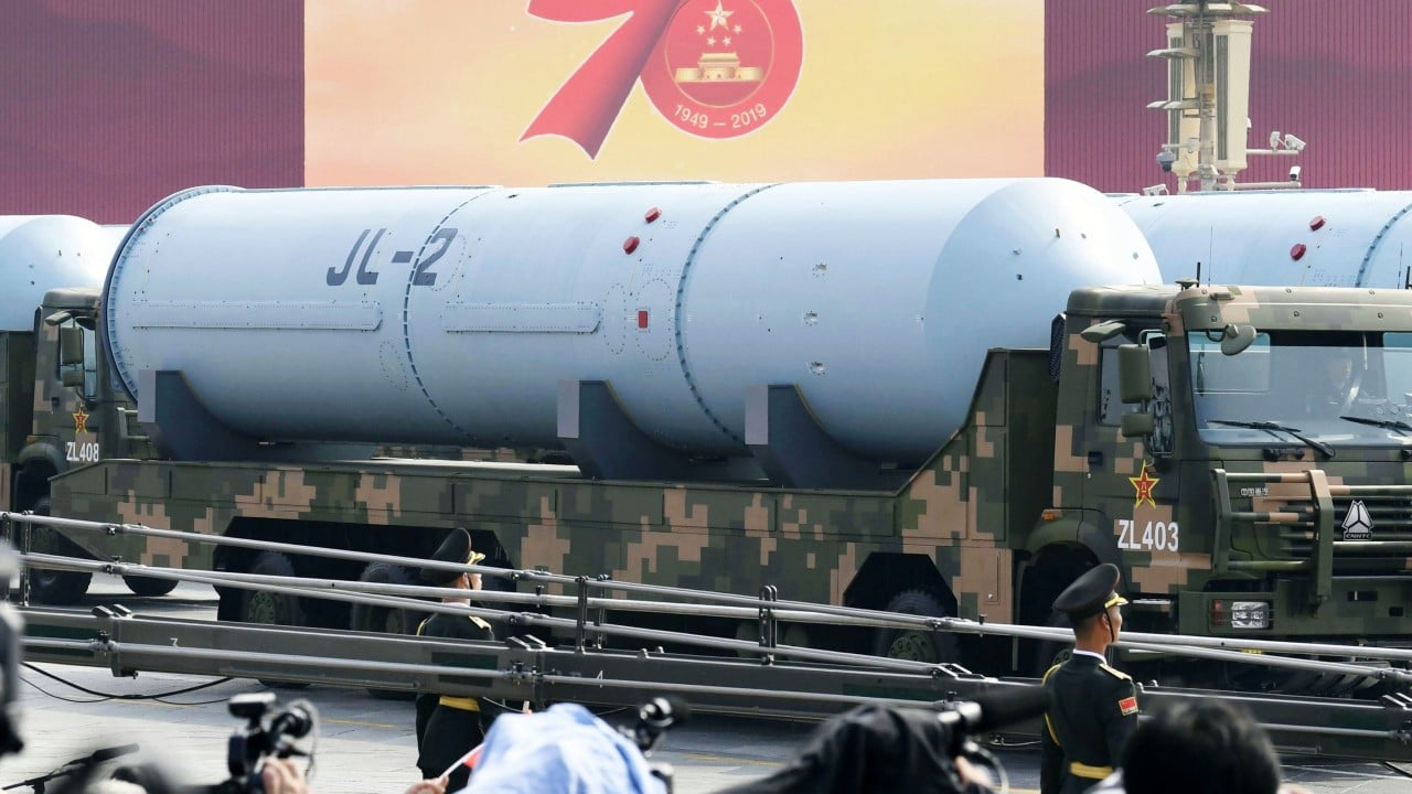
Taiwan's military did not merely watch China's recent submarine-launched ballistic missile test; they mapped its heartbeat from the moment it broke the ocean surface. When the People’s Liberation Army (PLA) fired a nuclear-capable JL-2 missile from the waters off Guangdong province, the tracking data did not come from an American satellite or a naval vessel in the South China Sea. It came from a sheer mountain peak in Hsinchu County, where a massive, ten-story concrete monolith peered through the clouds and caught the weapon mid-flight.
The Leshan Radar Station, housing a highly customized version of the U.S.-designed AN/FPS-115 PAVE PAWS early warning system, tracked the missile as it soared over the northern Philippines and splashed down 7,000 kilometers away in the Pacific. For Taipei, the successful tracking was a public triumph. For Beijing, it was a reminder that their cross-strait neighbor possesses eyes that can see deep into the Chinese mainland, piercing the veil of the PLA's most sensitive strategic operations.
Yet behind the official celebrations lies a more complicated, dangerous reality. The very asset that gives Taiwan its most critical defense advantage is also a giant, stationary bullseye that would likely be the first target destroyed in a hot war.
The Cold War Beast on a Taiwanese Peak
To understand why the Leshan facility is so vital, one must understand how it differs from standard military radar. Most tactical radars spin, mechanically sweeping the sky. Leshan’s PAVE PAWS (Phased Array Warning System) is an entirely different beast. It is a stationary, three-faced architectural structure standing over 100 feet tall on a 2,600-meter mountain.
Instead of moving parts, it relies on Active Electronically Scanned Array (AESA) technology.
- The Array: Each face contains thousands of tiny antenna elements.
- The Beam: By electronically altering the phase of the signals across these elements, the radar steers its energy beam across microsecond intervals.
- The Speed: It can shift from scanning the horizon to tracking multiple high-speed targets faster than a human can blink.
Operating in the Ultra High Frequency (UHF) band, the system creates an electronic "surveillance fence" that blankets a 240-degree arc. It does not wait for a missile to approach Taiwan. It detects the massive thermal and kinetic bloom of a ballistic missile shortly after liftoff, calculating the trajectory, speed, and projected impact point while the rocket motors are still burning.
With an estimated range of up to 5,000 kilometers, Leshan can effectively monitor air traffic, missile bases, and naval movements from the Korean Peninsula deep into inland China and down to the South China Sea.
The Intelligence Pipeline to Washington
The capability to track a submarine-launched ballistic missile (SLBM) like the JL-2 is a premium commodity. Submarine-launched weapons are China's primary tool for establishing a second-strike nuclear capability—the guarantee that even if land-based launch silos are wiped out in a conflict, deep-sea ballistic missile submarines can still retaliate. Tracking these launches from their initial phase is notoriously difficult.
Taipei did not keep this data to itself.
Government officials acknowledged that Taiwan tracked the missile during its initial flight stage and immediately fed that telemetry to the United States. This real-time intelligence sharing highlights the unacknowledged backbone of the U.S.-Taiwan security relationship. The radar was purchased from the United States under a deal signed at the turn of the millennium, ultimately costing Taiwan $1.4 billion by the time it went operational in 2013.
Washington did not assist in building this mountain outpost out of pure altruism. The data harvested by Leshan feeds directly into the wider American missile defense network, giving U.S. forces in the Pacific precious extra minutes to prep interceptors in Guam, Hawaii, or the continental mainland.
The Six-Minute Lifespan
Every military analyst in the region knows the brutal truth about the Leshan Radar Station. In the event of a full-scale invasion by the PLA, the facility is estimated to have a operational lifespan of roughly six minutes.
A stationary asset of that size cannot be hidden. Its coordinates are permanently locked into the guidance systems of hundreds of PLA short- and medium-range ballistic missiles, as well as land-attack cruise missiles positioned along the Chinese coast. The facility operates under a paradox: it is an unparalleled tool for preventing a surprise attack, but it cannot survive the attack it predicts.
Taiwan’s military is acutely aware of this vulnerability. To keep those six minutes from shrinking to zero, the mountain peak has been converted into one of the most heavily defended pieces of real estate in Asia.
Layered Defense Architecture
| Defense Layer | System Type | Primary Objective |
|---|---|---|
| Long-Range Air Defense | Sky Bow III (Tien Kung) / Patriot PAC-3 | Intercepting incoming ballistic and cruise missiles at high altitudes. |
| Short-Range Point Defense | Antiaircraft Cannons / CIWS | Shredding low-flying drones and precision-guided munitions that breach the outer missile shield. |
| Electronic Warfare | Advanced Jamming Arrays | Blinding the radar-homing seekers of incoming Chinese anti-radiation missiles. |
If the defenses hold, the radar continues to feed data to Taiwan’s road-mobile missile launchers. If they fail, Taiwan loses its primary eye on the sky, forcing its military to rely on decentralized, shorter-range mobile radar units that are harder for China to target but lack the deep-look capability of Leshan.
The Cost of Looking North and South
The financial burden of maintaining this infrastructure is a recurring flashpoint in Taipei’s defense debates. The $1.4 billion price tag was just the entry fee. The maintenance contracts, heavily reliant on American technical experts who live on the mountain side-by-side with Taiwanese troops, cost tens of millions of dollars annually.
American defense delegations have quietly floated the idea of Taiwan building a second PAVE PAWS-style radar in the southern part of the island to plug geographic blind spots and add redundancy to the network.
The suggestion has met significant domestic resistance. Critics point out that spending another billion-plus dollars on a stationary target is an outdated approach to asymmetric warfare. They argue that the capital would be better spent on hundreds of mobile, low-cost anti-ship missile launchers, sea mines, and decentralized drone swarms—the "porcupine strategy" designed to make an invasion too costly for Beijing to attempt.
The tracking of the JL-2 missile has temporarily quieted those critics, proving that the mountain monolith still delivers elite strategic value during gray-zone operations short of open war. It serves notice that surprise is a luxury Beijing does not possess in the western Pacific. The radar did its job, the data flowed across the ocean, and the tracking metrics proved that the multi-billion-dollar eye on the mountain remains wide open, watching and waiting for the moment the sky turns red.